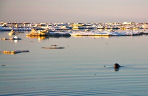
 A seal swims in the icy waters
I am sitting in the little Bering Air offices in a back corner of the already tiny Nome airport. It’s dank, dark, grey, and cold outside. 8:30 am and the sun won’t poke its head above the horizon for another hour or so. I am waiting to catch my flight from Nome to St. Michael via Unalakleet. I am flying through some daylight hours so I will be able to see part of this corner of Alaska from the air. The flight to Nome from Anchorage was dark with nothing to see. It took what seemed forever just to get through security in Anchorage. The highlight of the airport was flirting with a tall, sexy Russian girl who was working at the Starbucks. However, now that I am here, in Nome, I am in full swing adventure mode, preparing to live in the Yupik Eskimo village of St. Michael for the next several months of my life, training sled dogs and running dog-sledding trips into the Northwestern Arctic of Alaska and into the Russian Kamchadal region. Sitting here in the Nome airport, surrounded by the goings-on, I realize that I am minority out here, and that this will be the first time I have ever lived as such. There are not many Viking looking white-boys out here. This is Yupik country, and I am the outsider. At 6-feet 1-inches, and blonde, I “stand out” in the crowd, double entendre intended. Flying out of Nome and into St. Michael is a white-knuckle affair, and one that leaves a lasting impression of the isolation and austere vastness of the arctic. White, wind-whipped seas, and low rolling volcanic cones covered in arctic tundra are the only things you see as the plane makes its way across the lonely part of the world. After landing, my new boss takes me directly to a fuel tank farm where he immediately gets me to work, pumping out mud and water from around the tank perimeters. The first look at the village brings one word to mind, squalor. There is no doubt that while this is technically part of the United States, the village and area is essentially a third world country.
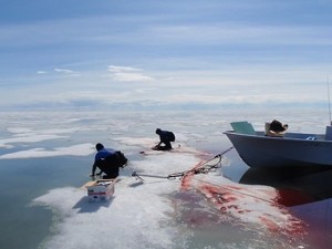 Hunting on the ice
Village life is filled with mud, garbage, human waste and more mud. It is generous to call the village ugly, yet the region surrounding it is somehow mystical. There is an intangible quality that hangs over the land, making it seem almost prehistoric. The only other place in the world I have experienced anything similar is in the remote regions of Iceland, another tundra covered northern land. There is no doubt that this is frontier living. Even in the 21st century, being here strikes a feeling of being on the edge. One Yupik elder describes this land by saying “it is not the end of the world, but you can see it from here.” Regarding the human interactions, this is the frontier as well, as disagreements are more often solved with fists or bullets than mediation. Beyond the thought that a mere disagreement may be met with fists, the biggest obstacle here as best I can figure is mud. Nasty, gross, filthy, dog-shit filled mud. It is everywhere and it is a part of life here before the snow and ice arrives. No outdoor gear purchased from fancy gear stores survives this stuff. This is the land where Carhartt, and industrial work clothes are essential. Wear a fancy-boy piece of Patagonia and it gets shredded in days. This is especially noticed when working the dog lot. This is my second day in, and I have started working the dogs and dog yard. The dogs get fed a mix of seal fat, high protein kibble and water twice a day. To get the seal fat, raw flippers and blubber get placed into a large outdoor double-boiler where it gets rendered down into a liquid tallow that gets poured over the kibble. Consider this high-octane fuel for the dogs as the calorie return on it is incredible. In addition to the seal fat, Tom Cod also get boiled down, into a soupy fish-broth given to the dogs. Don’t think that the seal and cod magically appear either; Glen, a Yupik, routinely goes out on seal hunts, and the cod is retrieved from nets dropped into the frigid Norton Sound. About every third day, I make a run out to the nets to pull up the fish, place them into large plastic tubs, then bring them back for boiling and rendering.
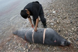 A caught seal is butchered
If this all sounds grimy and gross, I can tell you, it is. However, I am fortunate because my house is one of the only houses in the village that has its own shower. I am very lucky that after a day spent scooping dog waste, boiling seal fat and handling dogs I get to come home and take a hot shower. Most of the Yupik are not so lucky, as indoor plumbing is a rarity in these parts. For toilet needs, this is the land of the “honeypot”. Outhouses have holding pots called “honeypots” that are used for waste. As they fill up, you carry them out to the side of the muddy streets where they are collected by a weekly “poop-patrol” and they are then brought out to be dumped into a huge lagoon of human waste. Hepatitis runs rampant out here. Before you begin thinking it is all bad, let me tell you that the rewards out here truly help erase the bad. I was invited to go on seal hunts with the Yupik which is an honor and spectacle. As a “Gussiq” – white guy – I am not allowed to hunt the seals, and I don’t want to; but being invited to go out in the boats and observe the hunt, as well as be there on the beach when they return is an experience that is worth the hardship. I was taken out on my first seal hunt with Glen. He told me to “go dress like you’ve never dressed before” and to prepare for the nastiest conditions I could imagine. I put on two layers of long-underwear, an expedition weight top, primaloft pants, Gore-Tex bibs, arctic boots, a down jacket, glacier glasses, a parka mushing-overcoat, fur trapper hat, gloves, hat and seal furred mittens. Barely able to move, I waddled down to the beach where we all loaded into the boat and made our way out into the minus 10 degree weather. Even with all this, I was astonished at how fast my feet and fingers cooled down, and I am a seasoned high-altitude mountaineer. I can honestly say this was one of the most uncomfortable excursions I have participated in. Once out in the boat and floating through the pack ice, I was amazed at how astute, observant and aware the Yupik men are when hunting seal. Glen could spot a spotted seal head from at least a mile away. I have no idea how he pulls this off, but it is truly an amazing thing to see. Glen’s brother in law, Paul, came along and he shot two spotted seals. As we pulled up to the beach of St. Michael, many of the locals turned out for the butchering. The Y’upiq once hunted spotted seals using harpoons and hand-thrown “atlatls” – a combination slingshot and spear. Today, they use .22 caliber rifles to take the seals. Even so, the fact they can spot the seal out in the ice and land a shot is testimony to their skill and heritage of living with what the surroundings give them. When they hit a seal, it naturally floats due to the blubber and fat, making retrieval a matter of keeping an eye on the dead animal and navigating through the pack ice. The retrieval proved to be physical, and rough. Glen directed the boat through pack ice, and “bergie-bits” – loose chunks of ice that can be the size of Volkswagons. This is particularly dangerous, as the saying “the tip of the iceberg” is a reality. What you see on top is about 1/8 of what is below. Disturb it too much and it could roll, and take you with the boat out.
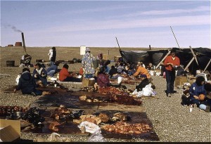 The haul is divied up by social caste
As Glen brought the boat up to the floating seals, Paul grabbed the gaff – a long metal hook – and handed it to me while he crouched low into the boat and held onto the sides. Paul directed me to thrust the tip of the hook as deep into the seal’s blubber and flesh as possible and then pull it in toward the side of the boat. If this sounds easy, it isn’t. While the seal’s body is covered in a blubber-layer, it is not soft. I had to truly swing the shit out of the gaff to bring it onto the dead seal’s back. Once the hook was set Paul told me to begin pulling it in toward the boat where he and Glen would pull it up and into the bottom. Pulling the seal across the water, and through ice is difficult as the seal weighs close to 300 or 400 lbs. Imagine trying to pull a black bear across an obstacle laden room and you get an idea of what it is to pull a seal through ice-filled water. I could only imagine how this was done when the Yupi’q would hunt the seals out of kayaks and skin boats. Paul and Glen yanked the seal up and into the boat, along with gallons of the briny and ice-cold water. It splashed everywhere and soaked us through our various layers of clothing, adding to the discomfort. Soaked gloves and mittens made the situation seem more dangerous as my fingers began to numb out with a rapidness I have never seen or experienced before. Once the seals were on the boat, Glen brought the boat back to the beaches of the village. I jumped out from the bow, and gripped the ice-covered line and began to pull the boat up with full force, taking advantage of the inertia and making sure to get the boat as far out of the water as possible. The three of us coordinated a lift and toss of the seals onto the beach. Again, our gloves were soaked, and every fiber of me was screaming to get the hell out of the cold and into the warmth of the house. There was still work to be done, and I had to stay with the men to prove my mettle as a measly Gusiq. This was where things really got interesting. Paul and Glen cut the seals up and handed out choice cuts and the ribs to the elders of the village. Everyone got some of the seal, but according to a “pecking order”. The elders got the best cuts while the village n’er do wells got the fat and entrails. It was something, watching this take place, knowing that it has been done this way for hundreds of years prior. This is not like going into a Safeway and buying a steak. After the beach-side butcher house antics, I retired to the house where I tried in vain to thaw out and heat my core and body back to normal levels. Once I recovered I bundled back up and went out to feed the dogs, which takes about an hour of time to prepare, dish out, and clean. The excess blubber from the seals would be used for the dog food and I would be responsible for boiling it down into the creamy tallow that gets added to the kibble. Spending time in the village, you fall into a pattern of work, sleep, and waiting for the weather to cooperate. Finally, snow hit us, and the dogs can get run. The dogs themselves know when the time is prime for sledding. They bark and howl and twitch with giddy anticipation with the thought of harnessing up and hitting the trails. I love each and every one of these dogs, but make no mistake, these dogs are not pets. The reality of dog-mushing is that the dogs are working dogs, born and bred to break trail and pull weight. When they know the time has come to run, they come alive. About Eric Cedric Eric Cedric is a former mountain guide and expedition leader with 20 years of professional experience. Cedric has worked on Denali, Elbrus and a handful of Himalayan peaks. In addition, Cedric is a private pilot and professional environmental and conservation writer. Cedric splits his time each year between the Adirondack Mountains, Southern California and Costa Rica.
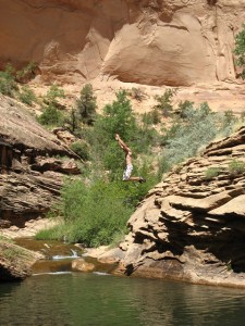
Mill Creek, UT
Mill Creek is a short hike to a nice pool with some shorter cliff diving, making it a popular destination. If you’re truly adventurous, treat yourself and hike further up the canyon to another pool. It does not have the sheer cliffs of the lower pool, but it is much more secluded. If you climb up the small waterfall at the end of the pool you can walk around to a small natural water slide. The waterfall is the destination for most, but continuing up canyon provides a nice hike in a beautiful setting. Climbing areas nearby: All the awesomeness near Moab. Getting there: From downtown Moab, head east on Center Street, turn right on 400 E, then left on Mill Creek Dr. Follow Mill Creek Dr. when it bears right at Sand Flats Rd. Finally, left on Powerhouse Lane until it ends at a dirt parking area. From the pullout you will see the trail heading east on the south (right) side of the stream. Less than 5 minutes from the car is a sandstone gorge below a small dam that provides a great place to hangout a short distance from the car. For the more adventurous, continue heading up canyon, staying on the well-used trail. The trail crosses the stream a few times, so don’t be afraid to get your feet wet right from the start.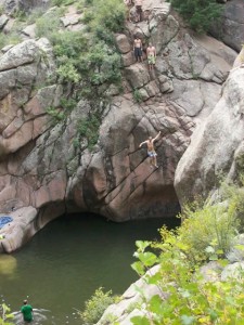
Paradise Cove, CO
Paradise cove used to be a word-of-mouth, locals-only hangout. Today it’s much easier to find this retreat, thanks to blabby writers like us. Here you’ll find sheer rock leading down to a very respectable pool. The pool is deep enough that only the truly brave touch bottom, and the water is free of obstacles. There is something for everyone -- from the tame 16 foot jump to the crazy 100 footer. There are also plenty of sun-soaked rocks to warm up on. Year round the water is brisk at best. Best visited on really hot days. Climbing areas nearby: Eleven Mile Canyon. Everything else in the South Platte Getting there: From Colorado Springs, drive west on U.S. Highway 24 for 26 mi. About a mile past Divide, turn left onto Twin Rocks Road. Drive 5.8 miles until the road dead ends at Teller County Road 1. Turn left and drive 5.9 miles to a fork in the road. Veer right on Teller County Road 11 and continue 4 miles until the road dead ends. Turn right onto Teller County Road 112. Drive 2.7 miles to a dirt parking lot on the left at the top of a small rise. The trail to the cove starts across the road. Follow a clear a half a mile to the pool.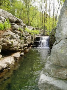
Split Rock, NY
The Mohonk Preserve outside New Paltz, NY is a climbing mecca. Home of the ‘Gunks’, the Mohonk preserve attracts thousands of climbers from around the world each year. However, during the summer, the heat and humidity can be nothing short of brutal. A dip in Split Rock can be more than just a welcome relief. Although Split Rock may not be the biggest secret, there are many places to swim in and around the preserve but Split Rock is not only the most secluded and serene but also contains the coolest water. Climbing areas nearby: The Gunks Getting there: From New Paltz head west on Co Rd. 299 until it dead ends. Make a left onto Hwy. 44 for about 1.5 mi. Go under the small bridge and follow the road to the bottom of the hill and look for the parking area on the right. From the parking lot head south on the trail to the Trapps and make the first left. In a few hundred yards find your refreshing oasis. You are required to have a preserve permit to use the area but if you show up early enough you may sneak by before the ranger station is staffed. Obviously, reverse the direction if you are coming right off the crag.Now for adventure!
Nearly 23 out of 700 islands are inhabited, which leaves a lot of room to explore. Most larger islands and even several cays have airports, and further exploration can be done via boat. With vast areas of reef, James Bond-inspiring landscapes, unique geological structures and rich fisheries, The Bahamas provide any type of outdoor adventure that you can think of including, spear fishing for lobster and grouper, scuba diving on unexplored reefs or blue holes, trekking through uninhabited islands and even surfing on the outer islands. One of the best ways to begin a tour of the Bahamian Islands is by flying into Exuma, also called the Pearl of the Bahamas, via Sky Bahamas or any other Bahamian airline. The Exumas are a tropical paradise made of a chain of 365 cays and islands stretching over 100 miles with two major islands, Great Exuma and Little Exuma. The northern tip is located 35 miles southeast of Nassau. The Exumas offer hundreds of miles of empty, pristine white-sand beaches, an over-abundance of marine activities and spectacular geological structures. The bright aquamarine water is so intensely colorful that it turns the clouds blue. The islands are dotted with towns of historical importance that were settled during England’s colonial rule as commerce hubs or plantation settlements. The Exumas’ culture exemplifies Bahamian lifestyle on the outer islands. The landscape dictates the way of life. Residents are easy-going and say that they would not live anywhere else in the world. Many catch their food from the sea daily and have a visceral connection to the delicate marine ecosystem. The best way to experience The Exumas’ adventures to the fullest potential is by chartering a boat to the northern islands and cays with Captain Pat Smith at Four C’s Adventures (http://www.exumawatertours.com/). Capt. Pat will have his boat ready to launch when you reach Baraterre, located at the northern tip of Greater Exuma. After you have made it this far, it's your marine playground. Here, the true adventure begins. During the full day excursion, Capt. Pat navigates north through crystal clear waters passing untouched beaches and celebrity-owned islands. Passengers can request to stop the boat to explore anything they desire including islands, reefs, sandbars or perhaps dock at locally owned bar along the way to chat with the locals about day-to-day life in the islands and cays. As a member of a guided tour, visitors are able to participate in some of the most Bahamian of activities, diving for conch and spearfishing for lobster. Guides have the local knowledge to ensure a successful hunt resulting in the most rewarding meals of a lifetime. Conch is a staple in the Bahamian diet, and conch salad is the most celebrated dish. Once lunch is caught, Capt. Pat will boat to a sandbar that rises from the middle of the sea. Then, he expertly butchers the conch and dices onions, tomatoes, green bell peppers and chiles. Add fresh lime juice, orange juice and sea salt and lunch is served. Staniel Cay provides a great base to explore the northern part of the Exumas. In fact, it is so perfectly positioned that it provided the base for the filming of the 1965 James Bond movie, Thunderball. Accommodations, boat rentals and kayak rentals are available at the Staniel Cay Yacht Club (www.stanielcay.com). Only a two minute boat ride from the Staniel Cay Yacht Club is the infamous Thunderball Grotto, an underwater cave saturated with tropical marine life and breathtaking underwater geological features. Be sure to bring a waterproof camera. If you are thrill-seeking and the tide is high enough, climb to the top of the cave (bring booties) and take the 20 foot plummet through the narrow hole at its peak. Staniel Cay is a scuba diver’s paradise. Located just a short boat ride north, the Exuma Cays Land and Sea Park offers 176 square miles of wildlife reserve and national park. The PADI dive center on the island, Staniel Cay Divers (http://www.stanielcaydivers.com) can guide divers to a range of sights -- from a relaxing drift dive for those looking to become certified to a technical deep water dive for the highly experienced. The adventurous owner/divemaster of Staniel Cay divers prides himself for quality over quantity, so crowds on the boar are never an issue. With countless dive spots never visited, the possibilities for new exploration are nearly endless. Danger Bay, located within the nature refuge proved to be a great dive. The dive begins with a 40 foot descent with reef sharks circling. After the descent, divers tour of the underwater coral maze teeming with eels, lion fish, lobsters, tropical fish and conch. After about 30 minutes of swimming through small caves and under overhanging coral structures the dive path winds back around to the boat where the sharks surround one last time. Divers of all levels are guaranteed to be pleased with the dive opportunities just a short boat ride from Staniel Cay, weather permitting. The PADI dive center is extremely accommodating and will find the right dive for any level of experience. Although exploring the Thunderball Grotto and the Exuma Cays Land and Sea Park provides the most the most adventurous experience around Staniel Cay, other locations can provide relaxing entertainment. Boaters can dock at nearby Compass Cay to swim with the island’s friendly nurse shark population or just pet them from the dock. Visitors can also find the swimming pigs of Big Major Cay. The geographic misplacement and unorthodox activities of the pigs has captured the fascination of visitors. Whether the pigs were brought intentionally as a food source or escaped a sinking vessel, the pigs have created a remote colony in the middle of the Exumas. After exploring the northern cays and islands, Greater Exuma and Little Exuma offer visitors plenty of opportunities for rest and relaxation. A day with OFF Island Adventures (www.offislandadventures.com) is the perfect way to finish an adventurous tour around the Exumas. Captain Steve’s laid-back, educational tour around Elizabeth Harbour is breathtaking. The 6th generation Bahamian will point out amazing rock structures, blue holes and world famous sandbars that attract top fashion icons for photo shoots, as well as the filming of the blockbusters, Pirates of the Caribbean II and III. As lunch time approaches or thirst sets in, ask Capt. Steve to stop by Chat N Chill on Stocking Island (http://www.chatnchill.com). The restaurant is off the beaten path and only accessible by boat. Public transportation is available by water taxi from the Government Dock in Georgetown. Chat N Chill epitomizes a tropical destination bar and grill. It is a great place to mingle with locals, play volleyball with new friends or find a secluded spot on the restaurant’s expansive beachfront property. If feeling particularly indigenous, order the famous Bahamian Goombay Smash and a conch burger. Do not miss out on the island’s pig roast every Sunday at noon; however, great food, drinks and conversation are guaranteed on any given day. For those feeling overly hedonistic, the Sandals Emerald Bay Resort and Spa (http://www.sandals.com/main/emerald/em-spa.cfm) offers a range of services designed to soothe mind and body. The deep tissue sports massage can be quite useful after snorkeling for dinner, diving with sharks and day-long boat excursions. After touring Nassau and The Exumas by land and sea, it is clear to me why Bahamians love their way of life. The country’s unique landscape and colonial history have shaped its people and culture. Bahamians depend on the vulnerable marine ecosystem as a food source and as an attraction for their thriving tourism industry. This respect for the sea and its gifts drives a nationwide respect for not only natural resources but for neighbors as well. The result is a nation with a low domestic crime rate and minimal environmental exploitation. The Bahamian people and their land are welcoming and hospitable. The love of their country is unwavering and infectious.Must-Do List:
- Dive in Exuma Cays Land and Sea Park in northern Exumas
- Visit the Greycliff Hotel, Restaurant, Wine Cellar and Cigar Company in Nassau
- Snorkel for conch and make your own conch salad
- Visit Chat N Chill (best on Sundays) on Stocking Island
- Explore the Thunderball Grotto just north of Staniel Cay
- Order lobster at Santana’s Bar and Grill in Williamstown, Little Exuma
About Jonas Ahern
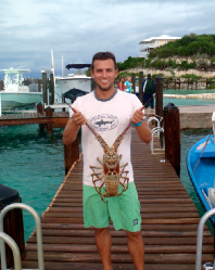 Jonas grew up in southern Delaware, coastal Maryland, and central Florida and attended the University of Florida. While earning a B.A. in History and a B.S. in Zoology, he discovered his love of travel, wine, craft beer and home brewing. During his study abroad in Sydney, Australia he became hooked on adventure travel. He backpacked through the Tasmanian wilderness, studied reef ecology on a small island in the Great Barrier Reef and endlessly searched for new and remote surf spots up and down the east coast of Australia.
After graduating from college, his obsession with adventure inspired him to pack up and drive cross country. He worked seasonally for two years between wineries in Northern California and a ski resort in Vail, Colorado. He now lives in New York City and works as a craft beer and wine specialist.
“Get two good hand jams and just do a pull up.” Brian calmly informs me. “Oh, just a pull up with a hand jam? Is that all?” “Yep, there are no good feet, you just have to go for it.” Brian's instructions do not inspire much confidence, but I do as I’m told and put my flat hands into the crack as far as I can and retract my fingers into my palm to create counter-force between the heel of my palm and the top of my knuckles against the warm sandstone. It feels as if I am climbing on 100 grit sandpaper as I apply enough force to effectively hold my body weight, if just barely. I can feel the skin being grated off my hands. This sacrifice, to be repeated time and again the next few days, it's a rite of passage into the world of crack climbing. No tape on this trip, it is a sacrifice after all. To those that are strictly face climbers, cracks are something of a mystery. I have always been intrigued by cracks and those that venture to some of the most remote corners of the world to climb them. As the owner of Front Range Climbing Company, Brian is a climber with an ability far beyond what I can even comprehend. Luckily, he is a good enough friend to tolerate my weak climbing abilities and complete lack of crack experience and invite me along with a few other guides, Mark, CJ, and Josh from Front Range Climbing Company to a desert climb outside Moab, Utah. Although the area surrounding Moab lays claim to some of the most visited desert climbing meccas in the world (including Indian Creek) there still are some areas that are relatively unexplored. Tusher Canyon is a favorite spot of Brian’s. Located about 30 minutes northwest of Moab, Tusher could almost be considered deserted wilderness. In the three days I spent climbing in Tusher Canyon I saw only one other vehicle, the driver of which was apparently too preoccupied with air conditioning to exit. Thankfully, this lack of spectators allows me to retain some of my dignity as I begin my pull-up and flail with my feet for anything they may help in my desperate bid for ‘up.’
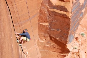
I finally manage to complete the opening move and begin to link hand jams with wedging my foot into the crack and twisting it to create something to stand on, a process known as ‘jamming,’ progressing about two body lengths much to the surprise of myself and all parties concerned. A rest is in order and I take the time to examine my hands which roughly resemble hamburger meat and leave small blood stains on the already red sandstone. I smile. The joy of being here overcomes the pain from my hands. Onward and upward! After a few more moves the crack begins to open until it’s large enough for me to arm-bar for my life. I rest. I can hear my belayer, Mark above me feeding me some much needed beta and I contemplate the next move. I Rest. Using what can only be described as an awkward shimmy I mange to move up higher into the expanding crack and make use of a chest jam. I rest. After what seems like an eternity I work my way high enough to make use of the coveted, but rarely used, ass jam. It becomes a shimmy up the crack using any means available. Chimney, counter-force, jams, it’s all fair game at this point. I rest. I feel slightly trapped as I struggle (in what can only be described as flailing) and finally see Mark, a welcome sight. I was exhausted and at the time was thinking maybe the desert was just too much for me. Maybe I had bitten of more than I could chew. Maybe these guys are just too far out of my league. But as the exhaustion was overcome by a feeling of euphoria I realized the two days I had left wouldn’t cure my new-found lust for crack climbing. Who knows, it may even become love. That night we sat around the campfire. Mark played the guitar and sang. We all drank and joked. We laughed and told stories and made fun of one another. We slept in the sand and in the back of trucks. Out here the wind blows the fine sand into every nook and cranny and my sleeping bag was no exception. The next morning broke cool and bright. Brian and Mark were already up making breakfast. I would need as much bacon as I could consume if I were to make it through the day’s activities. I eat. I silently question what I am doing out here with these guys. Then I hear Brian ask “ready?”, and I do what I always do, get up and grab some gear. The names escape me. Rubber Duck, Merge, Pile of Shit - Monkey Nuts, and a host of other oddly named routes chew at my hands and build my fondness for cracks, fueling my desire to return. There were triumphs and heartache and pain. Lots of pain. But mostly there was love. Love for the rock, the climbing, the people. But mostly there was love for the place.
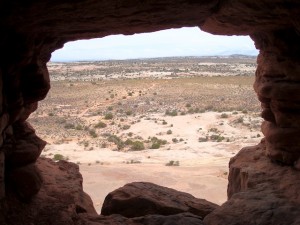
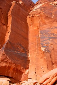
Seeing the rock in Tusher Canyon is nothing short of inspirational. Some blood red, some gray, some black. Multi-colored layers on all. Cracks can extend 300 feet into the sky on what may be some of the straightest, sharpest lines rivaling those made by man. A religious experience to be sure. On the last day we climbed the Echo Pinnacle. The Pinnacle climbs 270 straight out of the desert and at the top of the first pitch there is a large protected ledge and window that looks out to the East and West. Here we eat, talk, joke and laugh. We drive out of the canyon on that third day with the intense desert sun setting behind us as I reflect on the past couple of days. Cracks, it turns out, are all that I had expected and more. I expected the climbing to be hard. I underestimated them. The skin will regrow, but what will forever remain is my desire for more cracks.
Logistics:
Tusher Canyon lies about 30 minutes north of Moab, UT on US 191 and is easily accessed from I-70. Outside Moab, UT. What passes for roads in the canyon are more like trails -- rough and possibly impassable during some parts of the year. A high-clearance vehicle is recommended. Many areas of the canyon are rather developed whereas others have just a handful of routes with plenty of lines to be explored. Although you may run across a few climbers on Echo Pinnacle, if you continue deeper into the canyon to a dead end you can access the areas of Putterman, Neighbor of Putterman, and Convoy walls where chances are good you will be alone, even on the busiest of weekends. Not many people have attempted climbs back here and the potential for new routes is still high. Tusher Canyon is owned by the BLM and as such primitive camping is allowed around Tusher Canyon (although not in the dead-end canyon). Other facilities are not available without making the trip back to Moab. Obviously, water can be very scarce in the canyon so make sure you have sufficient quantity (more than you think you'll need) before setting out. Back in Moab you'll have all the facilities you could ask for. Pagan Mountaineering (59 South Main St. #2 Moab UT 84532 Phone: 435-259-1117) is the source for gear, and restaurants and hotels are plentiful. Weather can be a major consideration as the heat can be unbearable in the dead of summer. Early spring and late fall are perfect candidates for an epic desert trip.Alternate Climbs:
If you're looking for just a quick climb in the area, Wall Street (located on Route 279) is a good place for a quick send, although solitude is not something you will find here, especially on weekends. And, of course, Arches and Canyonlands National Parks are both great places for some climbing in their own right.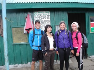
Day 1 (16 January 2011)
Nairobi – Nanyuki – Old Moses Camp
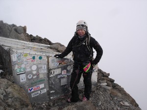
Lunch of pepper steak and chips followed by greetings by trekking guide, Daniel, and technical guide, Kim. Team photograph (2 guides, 2 porters, 1 cook) in front of 4×4 before setting off in it to Sirimon Gate @ 2650 meters above sea level. Rearranged packs at Sirimon Gate, swapping out the 80 liter Lowe Alpine pack for the 35 liter Berghaus day pack that Tom gifted me some years ago (old lover, old backpack) to one of the porters. Handed one of my Black Diamond Women’s trail lite compact hiking poles to Daniel and started the trek to Old Moses, where we spent our first night on the mountain. The Sirimon route leads up from the Mt. Kenya ring road some 14 kilometers east of Nanyuki. The route climbs over the northern moorlands. It’s renowned for wildlife and dry, green scenery and it's the most frequently trekked route up to Lenana. En route to Moses, I met a group of Bible-study Norwegian youths, spreading the word of Christian God throughout Kenya, and a Kenyan-Danish couple. Admittedly, I totally had a crush on one of the Norwegian Christian kids (ok, fine, two – Rune and Gisle, who, incidentally, is from Iceland but speaks Norwegian). First night’s dinner consisted of fried fish, potatoes, and veg. Didn’t have much of an appetite after my big breakfast of muesli, eggs, yogurt, fruit (not to mention the pepper steak lunch) but nibbled a bit. Finished up night with warm water wash and exfoliating cloths – luxury at its finest.
Day 2
Old Moses Camp (3300m) – Shipton’s Camp (4200m)
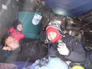
Early AM start through Ontulili River up Mackinders Valley via Liki North Ridge. Big breakfast of eggs, toast, sausage, porridge, passion fruit, pineapple – far too much to digest at 630 Kenyan time! Trekking proved to be harder than I thought – already at this point below 4000 meters sea level, and I had to slow down my pace or my heart would not have forgiven me. The itinerary called for 7 hours but my pace got me there in about 9. Stupid endurance. Began to get annoyed with guide at this point, with his frequent mobile phone chats and somewhat disregard for my pace and frustration. When it was finally time to lunch circa 14:00 at the ‘lunch point,’ it couldn’t have f*cking come sooner; I was starving and exhausted and the ‘picnic lunch’ was well deserved. And certainly munching on my ham cheese and butter sandwiches and Ribena in a surreal Joshua Tree-like setting below towering peaks and glaciers, furry rock hyrax (think non-spiky hedgehogs) and sunbirds was appreciated. At 4,000 meters, one really begins to notice vegetation that exist only here and at a few other lofty points in East Africa as a result of the combination of altitude and a position astride the equator, for example, the ‘water-holding cabbage,’ ‘ostrich plume plant,’ (whose skeletal remains would make for fantastic silver grey goth bijoux) or ‘giant groundsel,’ seemingly designed by some 1950s science fiction writer when first encountered – surreal indeed. Shipton’s camp: infested with bunk beds and rats – how is it possible that these f*ckers survive at 4200 meters when I nearly ripped off my head due to high altitude-inducing pounding hangover times hundred thousand headache? Napped for about twenty minutes upon arrival, only to be thwarted by obnoxious, burping, snoring, farting Czech tourists. Learned how to play kickass Icelandic card game. Sympathized with Norwegians and Danish and Kenyan couple for their upcoming 3am assault on Lenana (4985 meters). I would get my taste only a few hours later…
Day 3
Shipton’s Camp (3300m) – Point Lenana (4985m) – Austrian Hut (4700m)
MISERABLE SCREE. headaches. lemon tea. snow. ice. tears. nausea. Awoke many times through the night with a pounding headache and perturbed by the presence of rodents @ 4200 meters, rummaging through my pack in search of Clif and Luna bars. Breakfast of lemon tea with orange blossom honey, sausage, pancakes with peanut butter (or was that the day before?), eggs, bit of a rest, and greeted the Christian Norwegian kids goodbye before pushing straight for Lenana (which Lonely Planet describes as a tough 3.5-5 hour slog via Harris Tarn and the tricky north-face approach). Looking back after having summited, I suddenly don’t feel so crap about my pace. Also, I can’t help but laugh maniacally at myself after having realized just now I bagged both Point Lenana AND the bloody Summit Circuit on the way down from Lenana to Austrian Hut in the same bloody day: ‘While everyone who summits Point Lenana gets a small taste of the spectacular Summit Circuit, few trekkers ever grab the beautiful beast by the horns and hike its entire length. The trail encircles the main peaks of Mt Kenya between the 4300m and 4800m contour lines and offers challenging terrain, fabulous views and a splendid opportunity to familiarize yourself with this complex mountain. It’s also a fantastic way to acclimatize before bagging Point Lenana.’ Splendid and spectacular my ass! All I could remember on the way (incidentally, I took the Summit Circuit on my way down from Point Lenana so there was no such ‘fabulous’ acclimatisation opportunity) was MISERABLE SCREE! ‘Depending on your level of fitness, this route can take between four and nine hours. Some fit souls can bag Point Lenana (from Austrian Hut or Shipton’s Camp) and complete the Summit Circuit in the same day.’ Well, that was dumb, and I’m not _that_ fit but apparently my Kenyan guide (who did not want to insult me and my ‘level of fitness’ and hence agreed to take me up to Point Lenana then Austrian Hut the back way, trekking across MISERABLE SCREE) believed that I was. 8.5 grueling hours, headaches, vomiting, tears of anger, fear, and frustration later, I reached Austrian Hut after having summited Lenana 3 hours prior (~14:45).
Day 4
Austrian Hut (4700m) – Nelion (5188m) – Austrian Hut (4700m)
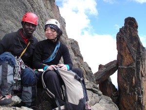
After the previous day’s debacle, in which a planned summit of Lenana and slog across scree to Austrian Hut (to better acclimatize and alleviate my AMS by climbing high and sleeping low) had taken 80% longer than anticipated (9 hours vs. 5 hours), I was rather uncertain about my ability to bag Nelion. The thought of an alpine start (4:00) after having suffered consecutive sleepless nights, headaches, nausea, aching quads, swollen fingers, and sheer exhaustion was not exactly the most exhilarating. I had spoken the night before with my technical guide, Kim, about the real possibility of turning back and abandoning the ascent midway if the AMS persisted and my pace and endurance were to take a toll (read: turn to shit) as a result. Surprisingly, I slept through the night and made sure to be diligent about striking a fine balance between hydrating sufficiently to battle the effects of altitude sickness and over-hydrating, resulting in countless trips to the bathroom (which, in the case of Austrian Hut, was a precarious uphill trek from the lodge across icy boulders in below freezing temperatures to the outhouse) in the middle of the night. Kim woke me up around 4, only to be greeted with a painfully pounding headache for the second day in a row, coupled with the pleasures of altitude-induced nausea, which resulted in a supreme loss of appetite; I had absolutely zero interest in putting away the hard-boiled egg, sausage, toast, pancakes, porridge, pineapple, and passion fruit that my cook, Joseph, had prepared for me, but forced myself to fuel up for the Nelion climb with a piece of toast, egg, fruit, and heaps of lemon tea to sooth the headache. Also, after much resistance, I finally succumbed to treating the effects of altitude sickness with Diamox, swallowing the bitter pill to cope with the headaches and nausea. 5:30: so far, so good. We trekked downhill before reaching the Lewis Glacier, where we strapped on our crampons and armed ourselves with ice axes for the trek across icy terrain. After having been on the mountain for three days, this was the first time that I had really experienced ice or snow, and it was stunning to see the peaks rising out of white pockets of snow deposits. According to the Mountain Club of Kenya’s Guide to Mount Kenya and Kilimanjaro, the Normal Route (via Nelion South Ridge, South East Face and Summit), is ‘rather complex, and much of the climbing is not above grade III (5.7)…Throughout the climb care is needed to avoid dislodging loose stones.’ Sounds straightforward enough. The apres-Lewis Glacier approach was itself an adventure, before the route finding even began: ‘From the Austrian Hut cross the Lewis Glacier and scramble up the scree, which has many precariously balanced boulders and can be dangerous in half-light.’ Awesome. More scree? And by the light of dawn? My favorite! After MISERABLE SCREE PART DEUX, we finally reached the base of the crag circa 7am, and began to gear up for the climb. Although my badassedness is usually in full effect when I climb, I was completely sketched out when Kim asked me if I wanted to ‘scramble’ (read: free solo) the first two pitches ropeless and I insisted that we rope up (my nerves were in full effect, tingling like mad, due to the effects of Diamox). The route starts up a side groove about 55m left of the Brocherel Couloir and although the first two pitches of climbing were indeed short (18m and 25m respectively) and easy, I could barely keep my eyes open and myself from yawning every 22 seconds, and couldn’t tell if this extreme exhaustion was a byproduct of Diamox, high altitude, the intensity of activity the last few days, or a combination of all. Even the most basic tasks (e.g. securing my Metolius PAS to the anchor system) required some assistance, because I felt myself fumbling with the 'biners and having a difficult time concentrating at times (blame it on the limited/lack of oxygen going to my normally big brain). The climb consisted mostly of cracks, chimneys, and traverses, and I was grateful to Kim at pitch 4 or 5 for his consideration of my rather weakened and pathetic state, asking whether I wanted to follow the more aggressive route involving a wicked overhang (my response: no thanks!) or climb a more conservative route. This kind of backing off was somewhat out of character for me, but there were too many unfamiliar elements and conditions at play, and the tendency to prove myself departed rather swiftly on the mountain (circa day 2, if I recall correctly). After climbing what seemed like 10+pitches (but was, in reality, probably only 6 or 7), we reached a tin shelter (Baillie’s Bivi) just below the notch beneath Mackinder’s Gendarme on the main ridge: ‘This is approximately half-way up Nelion.’ Please be kidding me. Again, the climbing was not technically difficult and weather was certainly on our side, but these 5.5- 5.6ish moves felt more like 5.10-5.11ish given the effects of high altitude. Also, although the weather conditions were friendly by mountain standards, I had packed only my hot pink Evolv rockstar climbing shoes and North Face Summit Series waterproof in my mountaineering bag to the summit, naively leaving behind my Scarpa mountaineering boots and down jacket – a move I came to regret as snow flurries greeted us on the traverse across snowy terrain to get up higher (and therefore colder) points. Luckily, I was clever enough to pack a pair of merino wool socks, which came in rather handy at the summit. A large gully, two short chimneys, and some traverses later, we reached the summit of Nelion circa 15:00. I was thrilled to discover a gem of a hut (Howell’s Hut) on the summit. Ian Howell built it in 1970 and boy did I feel like one lazy mofo as I crawled into the hut, sat down, and lunched on my packed ham, cheese, and butter sandwich and piece of Kenyan chicken leg whilst listening to my guide explain how the structure was built. The corrugated iron for the hut was dropped onto the Lewis Glacier by helicopter and then this Howell dude CARRIED it to the summit in thirteen solo ascents and built the hut. BADASS! One of the stark differences between rock climbing in my own backyard (aka The Gunks) and on Mount Kenya – aside from the obvious fact that the former is a ridge of bedrock in Ulster County, Sullivan County and Orange County in the state of New York, and the latter is a 5,199m stratovolcano created approximately 3 million years after the opening of the East African rift – is the descent. Gone is the luxury of a two or three pitch rappel when you’re on a mountain. This might seem self-evident (like, duh!), but it wasn’t to me (again, blame it on the high altitude), and I was less than thrilled to discover that we had to abseil 14 or 15 pitches down to the base of the crag. The abseiling wasn’t quite the walk in the park that I thought it would be, due to the weather changing on us (it had gone from sunny and warm to snowy and cold by mid-afternoon), somewhat sketchy down-climbing and traversing to get to the abseil bolts, and the fact that we were now a party of 5 (I had met up with the Polish couple I knew from the Lenana trek and their guide en route to the summit), increasing our rappel time. And the downward approach from the base of the crag is no simple Gunks ‘StairMaster,’ but another 1+ hour of precarious trekking down scree by nightfall, in the cold, with a headlamp: score. You can imagine my enthrall of having to put on crampons and trek uphill across Lewis Glacier after having descended scree (I guess icy scree > rock scree?) and 15 pitches; I kept myself motivated with the idea of being greeted by hot soggy ramen and Kenyan tea back at Austrian Hut. Certainly the descent was not pretty (but neither were any of my ascents) so I slogged on, often leaning lazily on to my ice axe and nearly toppling over on to the ice (at some point, I’m certain that I did, and Kim had to help me back up at least once or twice). Around 21:00, I returned to Austrian Hut cold, wet, bloody, and famished, at the awe of Daniel, my trekking guide: ‘You made it back! I did not think you would summit but felt very glad in my heart when I saw a dot on the mountain top through my binoculars and I knew that it was you. Here, let me take your pack.’ Thanks for the vote of confidence, buddy. And damn, that apres-summit soggy Kenyan ramen and hard-boiled egg hit the spot! As did my 20F down sleeping bag that night.Day 5
Bandas Huts near the base of Chogoria (2950m)
Newbie mountaineer mistake: you do not conquer the mountain; the mountain conquers you. A hard lesson learned, 100 kilometers and 5000 meters later, having battled equatorial sunburn, AMS (acute mountain sickness), blisters, swollen fingers, chapped lips, aching quads, greasy hair, and damn, this Tusker lager and bar of Spruengli Grand Cru Criollo de Maracaibo I picked up from Zurich airport consumed by the fireplace in my 1BR hut (Bandas) near the base of Chogoria gate (~2900 meters) tastes good.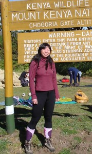 About Jeanne Fu
Jeanne suffers from a chronic case of wanderlust and is constantly in search of the next adventure. She has bouldered in France, climbed crags in California, China, and Colombia, surfed shore breaks and point breaks in Costa Rica and Peru, and trekked mountain trails in South Africa and rain forests in Argentina.
Born and bred in New York, NY, she spent summers in Shanghai – her parents’ hometown – and spent extensive time abroad, studying philosophy and languages in Scotland, India, Germany, and England. A former Fulbright Student Scholar, she earned her B.A. in Philosophy from Colgate University and M.Phil in Philosophy from University College London.
She speaks fluent German and Shanghainese, decent Spanish, aspires to brush up on her (now) very rusty French and Italian, and learn Portuguese to prepare for her upcoming surfing and climbing adventure in Rio de Janiero, Brazil. 
This article originally published in the September 2010 issue of Adventure Insider Magazine. Bellingham, Washington is a growing city that has been able to keep the smaller town charm while offering some really exciting adventures. Being in the northwest corner of Washington state between Bellingham Bay and the North Cascades Mountain range makes Bellingham great for both water and mountain adventures. Bellingham has received awards for everything from best paddling destination (Outside Magazine in August 2006) to 7th best locale for mountain biking (Mountain Bike magazine in June 2001) to being named one of the top adventure cities in the United States by National Geographic Adventure.
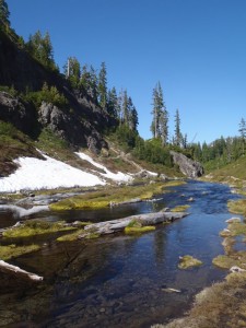
On your next (or first!) visit to Bellingham, be sure to head up to Mt. Baker. A 30-45 minute drive up Mt. Baker highway (Highway 542) from the city of Bellingham will get you to gorgeous hiking or skiing, depending on the season. When I went towards the end of July, Artist Point had just opened due to the walls of snow along the road and I actually got to do a bit of sledding. With over 200 miles of trails, there is definitely something for everyone from the beginner to the more advanced hiker (http://www.fs.fed.us/ r6/mbs/about/mbrd.shtml). After a day at Mt. Baker, fill up on some authentic Italian food at Milano’s Restaurant (http://www.MilanoRestaurant.us) in Glacier, just off of Highway 542, or grab a beer at North Fork Brewery (http:// northforkbrewery.com), also just off Highway 542. The North Fork Brewery, also known as a beer shrine and Wedding Chapel, makes hand-crafted British ales served directly to the tap room from serving tanks. If you forgot your bicycle or ski gear, head over to Fairhaven Bike & Ski (http://fairhavenbike.com). In addition to renting equipment, the store is also a great place to jump onto the Interurban Trail into Downtown Bellingham or over to the Larrabee State Park. Looking for a great brewery in town? Besides being voted Best Washington Brewery and Best IPA in the Northwest by Northwest Brewing News, at Boundary Bay Brewery (http://www.bbaybrewery.com) you can find live music, community events, and a great local crowd outside in the beer garden. It’s not just hiking, skiing, and biking, you can also find kayaking, sailing, and even whale watching within miles of Bellingham city limits. With so many year round activities, it’s easy to see why Bellingham is one of the best adventure locations in the United States.
About Abbie
Abbie lives in Southern California and, in addition to being a freelance writer, teaches preschool Special Education. Originally from Delaware, she moved to California after graduating from the University of Delaware with a Bachelor’s degree in early childhood development. Abbie earned a Master’s in special education from Cal State Fullerton while she developed a love for the outdoors and exploring. She has been an avid runner for more than ten years and has more recently taken up rock climbing. Abbie takes every break from teaching as an opportunity to get out and go (often with pups Daisy and Sadie in tow). Check out Abbie’s adventures on AbbieMood.com and keep and eye out for her soon-to-be re-launched travel sneakersandsuitcases.com, or on Twitter @AbbieMood! Abbie is an intern at the Matador Network, the budget expert for Planet Eye Traveler online magazine, and Managing Editor for Barefoot-Running.us. She has also contributed to BootsnAll, and Adventure World magazine. I was able to visit Bellingham courtesy of the Whatcom County Tourism Board, but the suggestions are based on my own opinions. [geo_mashup_map]
This article originally published in the September 2010 issue of Adventure Insider Magazine. The plan: a seemingly simple-to-navigate map that outlined hike and bike paths along the Sacred Valley including the villages of Ollantaytambo, Urubamba, Maras, Moray, and Salinas, a rusty mountain bike (which would have made my brother’s sixteen year old BMX look like a Bianchi Pista) I rented from the local hostel owner in Ollantaytambo for the bargain price of $15 a day, a rather ambitious plan to mountain bike to Maras, the ruins of Moray and continue onward to uncover the salt pans of Salinas and me, a native New Yorker and avid solo traveler, armed with a decent grasp of Español and not the slightest bit of mountain biking experience. 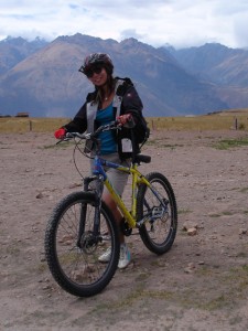
On day 6 of my Peru adventure, I arrived in the village of Ollantaytambo, located at the northwest end of the Incas’ ancestral homeland in the Rio Urubamba Valley, popularly known as El Valle Sagrado (the Sacred Valley). The Sacred Valley is fed by rivers which descend through adjoining valleys and gorges, and contains numerous archaeological remains and villages, most notably the Inca citadels of Pisac and Ollantaytambo Dominated by a massive Inca fortress above, Ollantaytambo is the best surviving example of Inca city planning; it has an orthogonal layout with four longitudinal streets crossed by seven parallel streets (think New York City’s grid street plan, only on a much smaller scale, and with narrow cobblestone streets). It also serves as a ubiquitous stopover in a quiet town for weary travelers en route to catch trains arriving from and departing to Aguas Calientes, better known as Machu Picchu Pueblo. A set of sunken terraces - 60 meters wide and up to 15 meters below the level of surrounding terraces - start south of Ollantaytambo’s Plaza de Armas, stretching all the way to the Urubamba River, about 700 meters. After having explored Ollantaytambo’s extensive agricultural terraces, which start at the bottom of the valleys and climb up the surrounding hills, I schlepped my 80 liter pack through town in search of a hostel according to my usual method of selection: leaf through the Lonely Planet guide, and then head over to the nearest recommendation. Unfortunately, said hostel was fully booked, so the schlepping continued until I reached Chaska Wasi, a lovely lodge with basic rooms, electric showers (a must for those cold Andean nights!), and much to my surprise, bicycles for rent. To prepare for the next day’s mountain biking adventures, I treated myself to an elegant fried Peruvian chicken dinner, two glasses of Chilean Cabernet Sauvignon, and a Pisco cocktail at Kusicoylloy, a stylish underground café adorned with golden décor, a tempting wine list, high culinary standards, and a convenient location offering views of the Incan ruins. The next morning, I set off for Moray. Admittedly, the journey to Moray from Ollantaytambo was itself an adventure, contrary to what my guide book had to say about the whole affair:
‘Refreshingly off the beaten path, though not that challenging to reach. Catch one of the frequent buses(combi) from Urubamba’s bus terminals to Chinchero . Ask driver to drop you off at the turnoff for the road to Maras. Taxis usually wait at this turnoff to drive tourists to Moray.’
To get to Urubamba, I rode a shared taxi (collectivo) with my mountain bike, helmet, and air pump crammed in the boot. Urubamba might best be described by the following: “an unappealing but necessary transit hub of little historical interest; it’s surrounded by beautiful countryside and makes a convenient base from which to explore the extraordinary Salinas and terracing of Moray”. One Maras-bound bus and Moray-bound private taxi later, I finally arrived at the ruins of Moray. The impressively deep amphitheater-like terracing of Moray is indeed a fascinating spectacle. Different levels of concentric terraces are carved into a huge earthen bowl that appear like modern crop circles, ironic considering the use of the terraces. 
I should mention that I was warned by my taxi driver en route to Moray not to attempt to bike to the salt pans of Salinas from Moray due to the steep and somewhat un-kept nature of the trails but should instead combine a visit to Moray with Salinas via taxicab; However, being proud, stubborn, and cynical (quintessential New York traits), promptly ignored him, assuming that he mistook me for a typical American tourist and therefore tried to rip me off for cash. I parked my bike outside the Moray archaeological site and was greeted by a friendly and helpful guide, Jose, who gave me a tour of the Inca ruins, explaining the significance of the enormous terraced circular depressions –the largest of which is about 30 m (98 ft) deep – and how they were used as agricultural and spiritual zones by the Incas. He also helped me to navigate the map that outlined the path to Salinas from Moray, confirming that there was indeed a trail (camineto) in the back roads of the Andes that one could take that would lead directly to the extensive terracing salt areas of Salinas, bypassing the rather unpleasant asphalt road that must be shared with vehicles headed to Maras. He instructed me to turn left at a ‘blue sign post,’ although, given my elementary grasp of Spanish, I mostly understood ‘blue’ (azul) something and nodded as he pointed to a bright blue spot in the distance, on the left hand side of the road. As I set off for the bright blue spot across the distance, I recall another American tourist, fresh off the bus, saying to me, ‘Wow, you must be real spontaneous and adventurous – setting off by yourself on a bike into the mountains like that. You go, girl!’ Spontaneous – or incredibly stupid, as I had realized shortly after setting off that I was running low on water and was crap at reading maps or orienteering myself, and probably should have taken a compass – or better yet a guide – along with me. 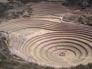
The first fifteen minutes of riding seemed straightforward enough, although not particularly scenic, as I cycled down a dusty, narrow asphalt road with passing trucks and cars. After passing by a number of barn-like doors and sign posts on my downhill ride, I began to lose sight of the bright blue landmark that indicated the turnoff to reach the back roads, and began to worry. Even I, as directionally challenged as I am, realized that something was not quite right and the road on which I was riding would simply lead me back to Maras, out of the way to the salt pans of Salinas. Numerous attempts to ask locals about the best way to get back on track to the Salinas-bound camineto were met with confused faces and incomprehensible Spanish/ Quechuan (the language of the indigenous people of the Andes), with fingers pointed in all sorts of directions – abajo (down there!), izquierda (to the left!) derecha (to the right!), derecho (keep going straight!). At least all confirmed that the road I was on did indeed lead back to Maras, and that my best bet was to cycle back towards Moray to orient myself. As so I did, after about 2 hours of riding, feeling pangs of defeat, dehydration, and hunger. On the way back to Moray, I spotted something blue, but was too paranoid at this point to trust my own instincts. So instead I sat right below the blueish thing and munched on the lunch consisting of an apple and empanada I had brought with me while I gathered my thoughts and resolved, reluctantly, to return to Moray and admit to Jose that I had somehow gotten lost. Still defeated and dehydrated but no longer hungry, I rode back on the asphalt road to Moray, running into a young local boy on the way. I showed him the now-not-sosimple- to-navigate-map and he confirmed the existence of a camineto that bypassed the asphalt roads but delivered some not-so-pleasant news: there was not only a camineto, but a network of them – quite complex and convoluted to navigate, and using the trails to get to Salinas and then Urubamba would alone take several hours. The problem was that I only had about a couple to spare, as I had to get back to Ollantaytambo in the evening to catch a Macchu Picchu-bound train. When I had reached the ruins of Moray for the second time that day, Jose, my guide, was quite surprised not only to see me again but also to hear that I had trouble locating the turnoff, which he confirmed was indeed the bright blueish sign post under which I had lunched. I then relayed the story about the intricate network of caminetos that the young boy had told me, and Jose’s response, though somewhat laughable in hindsight, struck a bit of fear in my heart at the time: ‘It’s easy – just take the one in the middle. That will lead you to Salinas. Actually, maybe you should just bike back to Maras and then head to Salinas from there so that you don’t get lost again.’ Again, the determined and somewhat stubborn New Yorker in me resolved to find this elusive camineto to see the incredible salt pans of Salinas before I could throw in my bike helmet and call it a day, though the lack of time and increasingly complicated nature of the route was beginning to worry me at this point, New Yorker or not. 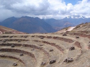
Back on the asphalt road again, I was enthralled to discover that turning left at the blueish sign post thing did indeed lead to a dirt road winding through the Andes. The feeling of autonomy and ecstasy that accompanied the ride through the Andean Mountains was inspiring, and suddenly defeat had washed away, transforming itself into my second wind. This relief was short-lived however, and the trouble began (although arguably, it probably began with the renting of the bike in the first place) when said dirt road led to many dirt roads curving through the mountainside and Jose’s suggestion, ‘take the middle one’ no longer seemed applicable; there were over half a dozen paths and not a soul in sight. Things only worsened an hour later, when I had run out of water and cell phone reception and realized that I had just carried my bicycle up and down the dirt road in a circle, passing by the same familiar puddle of water in an otherwise arid Andean landscape. The sun was getting closer to setting and my time was running out. Sweaty, cold, thirsty and tired from lugging that damned bike up and down the trails in search of any sign of life, I recall having a minute-long panic attack as I tried desperately to retrace my route back and plan the next best course of action. Although I could make out Moray and Maras far in the distance, the grade and complexity of the trails made it difficult for me to cut across to where I had come from. I was no longer concerned with seeing those silly salt pans, but just wanted to get back to Maras before dark and subsequently catch a cab to Ollantaytambo to make my Macchu Picchu train. After hiking back up the path with my bike in tow, I came across a remote Quechuan farm, out of the reach of motorized vehicles, and ran across the field leaving the bike behind so as not to do too much damage to their farmland although still wearing my helmet attempting to communicate in notso- composed Spanish about my plight to get back to Maras in time to reach Macchu Picchu. The Quechuan farmer reacted more kindly than I deserved, replying in a rather relaxed voice, all things considered: ‘Ah Maras? That’s easy – it’s just over there’ and offered me some homemade liquor. Certainly I had never encountered this kind of quaint hospitality back in New York (typically, most natives (or at least I) would simply point tourists in the opposite direction of where they wanted to go, let alone be so kind as to offer them a dirty martini). Although I could have used a drink, I politely declined and admitted my shameful lack of navigation skills ‘Yes, I have heard that it’s easy from a few people now, but I seem to be having quite a time finding this route – would you please show me the way back?,’ as I offered him 20 soles ($7) and he offered the help of his son – a sweet young boy named Vidal to accompany me back to Maras. 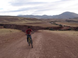
Vidal, eighteen years old and aspiring to study engineering in Cusco, had never met an American before me, and politely pointed out where I should have headed north instead of south to reach Salinas which as it turns out is right at the puddle I’ve seen all too many times. I laughed at myself a little and admitted that I had suspected that was the point where things had all gone wrong. By now, I had buried any desire to see Salinas so deep that those salt pans were simply dead to me, and I was thrilled and relieved to be greeted by goats and locals in their stylish Bowler hats as Vidal led me safely back to the town of Maras, where he helped arrange a cab for me to Ollantaytambo. Leafing through Lonely Planet 10 months later, I can’t help but chuckle to myself when reading:
‘From Moray it is supposedly possible to continue walking to Salinas about 6km away and then downward to the Rio Urubamba, which can fill a long but satisfying day. Ask the guard in Moray to point out the faint and not well-used trail, as it can be very hard to find. Most locals recommend backtracking to Maras first.’
Adventurer or not, stubbornness and a lack of preparation might best be left behind on such expeditions. But always pack an open mind, some local language (and map-reading) skills, adequate water supply, a compass, and faith in yourself and others. And although I will return to El Valle Sagrado (Sacred Valley) to pay homage to the salt gods of Salinas, I might take the beaten track (and path of prudence) the second time around and hire a taxi driver to take me to the terraced Inca salt fields on the way back from Moray. Or better yet, bring along a friend with far superior mountain biking and navigation skills than I. And the next time a lost New York City tourist stops me in the street for directions, I’ll give her the Quechuan treatment (well, maybe minus the dirty martini offer).
About Jeanne Fu
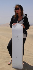
Jeanne suffers from a chronic case of wanderlust and is constantly in search of the next adventure. She has bouldered in France, climbed crags in California, China, and Colombia, surfed shore breaks and point breaks in Costa Rica and Peru, and trekked mountain trails in South Africa and rain forests in Argentina. Born and bred in New York, NY, she spent summers in Shanghai – her parents’ hometown – and spent extensive time abroad, studying philosophy and languages in Scotland, India, Germany, and England. A former Fulbright Student Scholar, she earned her B.A. in Philosophy from Colgate University and M.Phil in Philosophy from University College London. She speaks fluent German and Shanghainese, decent Spanish, aspires to brush up on her (now) very rusty French and Italian, and learn Portuguese to prepare for her upcoming surfing and climbing adventure in Rio de Janiero, Brazil. [geo_mashup_map]
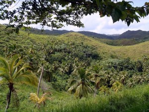
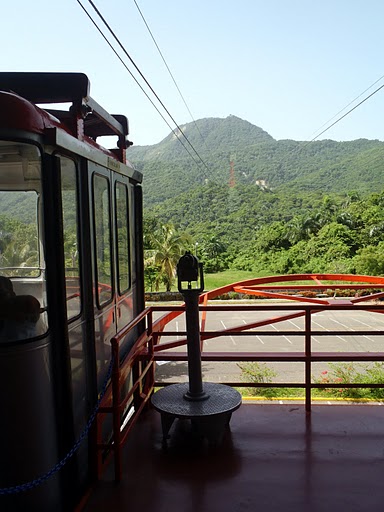
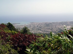
The North Coast of the Dominican Republic is quickly gaining a reputation for being one of the next big adventure spots. With everything from diving to hiking to kiteboarding and windsurfing, it’s easy to see why. On a recent trip sponsored by the Ministry of Tourism, I was able to experience some of these activities firsthand. The Samaná Peninsula is a great starting place. It’s roughly a 3.5 hour drive from the airport in Santo Domingo, or a 2.5 hour drive from the airport in Puerto Plato. There are quite a few all-inclusive resorts and a couple bars in the town of Samaná on the southern part of the peninsula, but if you are looking for something more low-key, I would suggest staying in Las Terrenas on the northern part. Las Terrenas is becoming more developed, but still has some good hotel options, great restaurants, and public beaches if you want to hang out with the locals. Besides the miles and miles of beautiful beaches, there are two main attractions in this area - Salto de Limón and Los Haitises National Park.
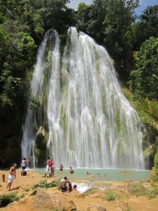
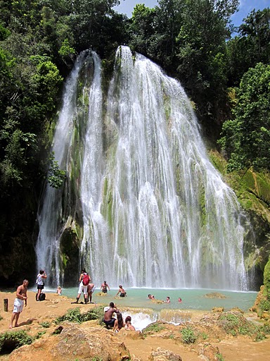
The Limón waterfall is just 1 km away from Las Terrenas, and can be reached by horseback or by hiking the (roughly) 4 km trail through the Dominican vegetation and across crystal clear streams. If you decide to go by horseback, I would recommend Parada Basilio y Ramona (Tel. 829-661- 4137 or email
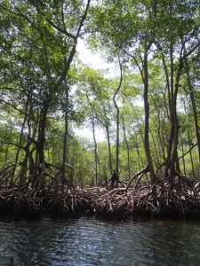
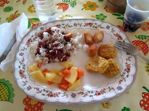
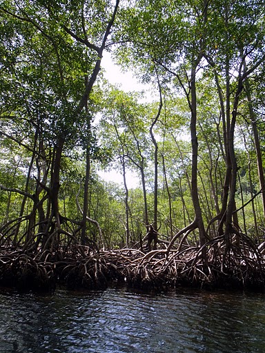
The park looks like something from a movie, with white sandy beaches, lush green forests, and rocky cliffs. Ride through mangroves, and past Cayo de los Pájaros, where hundreds of birds have made their homes. There are several caves throughout the park, etched with pictographs from the Tainos Indians, the original inhabitants of the area. There are several isolated beaches along the coast of the park that you could stop at, or hang out with the fisherman before they head back into town to sell their catch. We visited Los Haitises with Amilka Tours, who will pick you up from your hotel in Las Terrenas and take you to their dock. If you would rather get there yourself, they are located in the town of Sanchez. They also provide a traditional Dominican meal upon returning, for a total for $45 USD, including transportation. Cabarete is the outdoor activity capital of the Dominican Republic, and is roughly 2 hours northwest of the Samaná Peninsula. With both native Dominicans and a high population of expats from all over the world, this is the place to be outside all day and grab a beer at a beachside bar afterwards. If you walk the beach at Cabarete you will see windsurfers and kiteboarders everywhere – both in the water and on the beach. You can stop pretty much anywhere along the main drag and rent a board or get a lesson. If you want more information about kiteboarding, visit Cabarete Kiteboarding. If windsurfing is more your style, visit Cabarete Windsurfing for all the details you need.
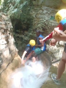
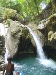
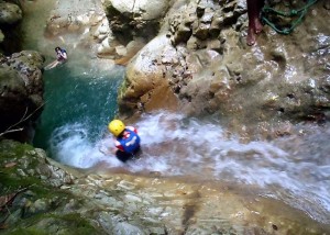
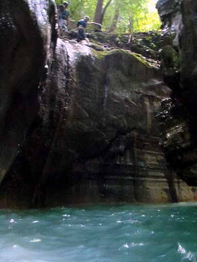
If you are looking for adventure, this is it. Start with your life jacket and helmet and follow the guide into the forest and across streams until you arrive at the first fall. They get your confidence up by giving you a ladder for the first one, but after that its rope climbing and pulling yourself up against the rushing water (with some help from the guides if you need it). Once you get to the last waterfall, the only way back down is to jump off 25 foot cliffs and slide down natural water shoots. We went with a guide from Iguana Mama, located in the middle of Cabarete, who will pick you up from your hotel in Cabarete and guide you up the 27 Falls for $79 USD (not including tax). Iguana Mama also leads eco-responsible tours for those interested in mountain biking, hiking & ziplining, diving & snorkeling, rafting & kayaking, and horseback riding. Just (approximately) 10 miles west of Cabarete, Sosúa is it’s own town, but with all the action in Cabarete, it makes sense to catch a ride to get to the nearby diving. I had never been snorkeling before, so I wasn’t quite sure what to expect. We went out with North Coast Diving, who were very knowledgeable and helpful for a first-time snorkeler, but also have a variety of trips for serious divers.
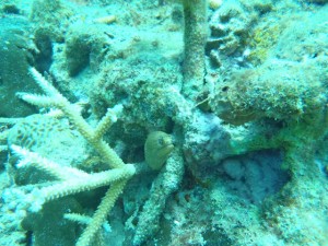
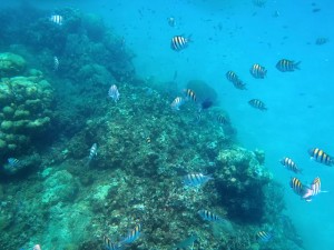
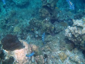
We stopped at the Three Rocks area and jumped in. As soon as I put my head underwater I saw all kinds of ocean life – tiny yellow fish, blue striped fish, coral, sea plants. I was so glad to have an underwater camera. The guide even dove down and snapped a picture of an eel that was hiding from us! We went to another site and saw tons of fish there, too. It was definitely an amazing experience. The 3 hour snorkeling cruise is $45 USD and includes equipment, snacks, a guide, a fish identification chart, and the chartered boat with a canopy to get out of the sun. North Coast Diving will pick you up in Cabarete for $15 USD round-trip.
What you need to know
Now is a great time to visit the North Coast because even though it’s gaining a reputation for adventure activities, it is not yet as crazy as some of the beach destinations like Punta Cana. Most tourists visit between December and April, so unless you like the crowds, I would plan a visit between May-October. The rainy season is technically from May/June-October/November, but the North Coast doesn’t really get hurricanes like other Caribbean countries, so if you can handle on-again, off-again rain, you should be fine. Visa fee - There is currently a $10 visa fee to pay upon your arrival at the airport, but no fee to leave. Currency - The Dominican Republic peso and the American dollar can both be used. Major credit cards are usually accepted. Water - Drink bottled water or bring a purification system. Depending on your hotel, you may be able to drink their tap water, but it’s probably best to be safe and go with bottled. A great website with any other information you might need to know is Go Dominican Republic. For more photos, check out my Adventure Insider Dominican Republic photo essay!About Abbie

Abbie lives in Southern California and, in addition to being a freelance writer, teaches preschool Special Education. Originally from Delaware, she moved to California after graduating from the University of Delaware with a Bachelor’s degree in early childhood development. Abbie earned a Master’s in special education from Cal State Fullerton while she developed a love for the outdoors and exploring. She has been an avid runner for more than ten years and has more recently taken up rock climbing. Abbie takes every break from teaching as an opportunity to get out and go (often with pups Daisy and Sadie in tow). Check out Abbie’s adventures on AbbieMood.com and keep and eye out for her soon-to-be re-launched travel sneakersandsuitcases.com, or on Twitter @AbbieMood! Abbie is an intern at the Matador Network, the budget expert for Planet Eye Traveler online magazine, and Managing Editor for Barefoot-Running.us. She has also contributed to BootsnAll, and Adventure World magazine. While the trip was sponsored by the Ministry of Tourism, any opinions expressed are my own. [geo_mashup_map]

Look for a full length feature on why the North Coast is the new destination for adventure travelers in the debut issue of Adventure Insider mag in a few weeks! Make sure you subscribe to Adventure Insider Magazine
We had originally hoped to do a boat trip through Palo Verde National Park, but the tour operator called in sick at the last minute and couldn't take us out. In all fairness we had tried to schedule the trip just the day prior, but alas, it wasn't meant to be. So we decided to do something we hadn't done the whole trip -- relax. The pools at Pacifico had remained unexplored for the duration of our trip, the piña coladas weren't going to drink themselves, so we were happy to oblige. It was nice not to have an itinerary and just relax and goof around. A nice dinner and drinks with Abby from http://www.thejungleprincess.com/ capped the day. Day 10 may be a bit of a misnomer as it was really just 12 hours spent on planes. We did barely make our connection in Houston due to delays clearing immigration and customs, but all's well that ends well. What now? Well first I have to get used to the cold and rain that we met on our return to New York (a far cry from the sun and heat of Costa Rica). But it's only for a couple days of as I'm headed to Colorado and Utah on Friday for a couple weeks of climbing,skiing, and whatever other trouble I can manage to find... Happy trails!
Our trip is drawing to a close. And, although we have accomplished most of what we were hoping to do and seen much of what we had hoped to see, we seem to be getting started later into the morning. So yesterday we decided to play things sort of close to our base camp in Playa del Coco. We set out heading southeast on the Pan American Highway (highway 1) toward the northeastern edge of the Parque Nacional Palo Verde. We decided to make a stop at the Rescue Shelter Las Pumas located 5km north of Cañas. Unless you are hiking in some of the most remote protected areas of Costa Rica, you're unlikely to see any of the large cats native to this region. So, rescue shelters like this one offer pretty much your only opportunity to see jaguars, margays, ocelots, pumas, jaguarundis, and pumas as well as gray fox, lots of parrots, toucans, and a very playful river otter, and capuchin and spider monkeys. The shelter relies on entrance fees and donations to care for these rescued animals -- all the animals have a sad story and some bear physical scars of their past abuses. It is a last resort -- releasing these animals back into the wild is simply too dangerous for them. It was a great experience to see these magnificent animals up close but also a sobering reminder of the cruelty imposed by some and the consequences of human sprawl. Afterward, we headed to a waterfall around 2km off the Pan American Highway 3km north of Bagaces known as Llanos de Cortés. The waterfall and surrounding gold-flecked sand beach is a well-known spot to Ticos, but off the beaten tourist path. The road to Llanos de Cortés is 1.3km of unimproved dirt road leading to a large parking lot that seemed pretty full. After paying $2 to the parking lot security guards, we hiked a short, steep path down to the waterfall where we enjoyed our picnic lunch and a refreshing swim in the pool under the falls. All told, there were probably around 150 people hanging out there, but it was a beautiful, sunny Sunday afternoon and easily 95% of the crowd was Tico. Everyone was friendly and clearly enjoying the swimming and diving. There were a couple of barbecues set up and a generally festive atmosphere. A short path to the left of the falls led to the top of the falls where there were only a few people. Great for solitude and a wholly different perspective on the falls. In the late afternoon, we packed up and returned to Playa del Coco for dinner at a local seafood joint, Papagayo, and a relaxing evening on the lanai.
We headed southwest from Playa del Coco to the town of Tamarindo to try our hand at some surfing. Tamarindo is not what I would call authentic Tico -- gringos and tourists abound, but the beach is nice and the waves are great for learning to surf. We booked our lesson at the Iguana Surf Shop. Iguana runs four two-hour lessons each day, starting at 9, 11, 1, and 3. Each instructor can instruct up to four people and the cost is $45 per person (includes a souvenir tee-shirt!). Turns out surfing really is a lot more difficult than it looks, but all four of us were able to stand up on the board within about 20 minutes. I'm still not sure if my snowboarding experience helped me much, although it's probably didn't hurt. If anything it may have helped my steering and fore-aft balance, but the trickiest part is getting up to the standing position, which is unique to surfing. Our lesson left us tired and sore and with some new bumps and bruises, but we all agreed that it was all worth it for the feeling you get when ride your first wave (dude!). After surfing we did the tourist thing (...when in Tamarindo...). We hit the main drag with two goals: souvenirs and cocktails. Among the many trinket stores there are a couple of standouts. One of our favorites, Roots Gallery, features bowls from locally sourced wood created by the shop attendant's husband, Edwardo. Each piece is handcrafted and unique. With gifts in hand, we headed to Le Beach Club, a beach-front, gringo-heavy bar/restaurant down the main street. Service was a little slow, but it was nice to relax with a few cocktails and take in the sunset. As the tide went out, the surfers gave way to the pelicans diving for fish in the increasingly shallow water. Parking on the beach across from the Iguana costs ¢3,000, but it is worth paying because there is a security guard who will keep an eye on your car. I would still warn against leaving anything valuable in your car -- we received multiple warnings about how common theft is in these parts, but the guard was still vigilant when we returned to our car about 2 hours after sunset (earning our ¡Gracias! and a nice tip...). Iguana Surf Shop also rents boards for as long as a week, rents kayaks, runs shuttles to other beaches, and runs snorkeling trips. Check out Iguana Surf Shop online at http://www.iguanasurf.net/
Ok, I admit I have been a little lax in posting updates, not to mention somewhat removed from most things electronic... Day three involved a road-trip to La Fortuna and the Árenal Volcano. Almost immediately upon arrival that afternoon we took a hoseback ride to view the Pino Blanco and La Fortuna waterfalls. Although recent rains and high water levels prevented us from swimming in the pool beneath the La Fortuna waterfall, the views were amazing, both from the observation deck at the top of the trail and along the trek down to the La Fortuna waterfall. (Photo essay to follow....) We overnighted at Arenal Paraiso, where we enjoyed a soak in the therapeutic thermal mineral springs, of which the resort sports 13, one with a bar. I awoke on day four with a sore back no doubt due at least in part to my less-than-stellar equestrian form on our ride the previous day. Nonetheless we pressed on. The agenda for the day included a combination of canyoneering (including a combination of rappelling and river hiking) in the morning followed by whitewater rafting in the afternoon organized through one of the larger adventure tour companies in Costa Rica, Desafio. A light breakfast and lunch were included in the 'Mambo Combo'. All in all, it was a great time -- even Elizabeth (who has a little trouble with heights) enjoyed the rappelling, thanks in large part to our friendly and reassuring guides, Elio and Ronny. The rafting portion took us over Class II and III rapids which were strong enough to provide a great time, yet easy enough for whitewater newbies. There were even several families with kids on the trip. And one more shout-out to our rafting guide Carlos, who gave us a thorough safety demo and then made sure we had a lot of fun on the trip down the river. On day five, the clouds finally lifted and we were offered our first opportunity to view the peak of the Árenal Volcano.We took a quick jaunt up to the Árenal Observatory Lodge (formerly a Smithsonian observation station). There is a ¢4,000 per person entry fee to drive up to the Lodge, but the views are worth it. The lodge has a restaurant and a large deck the offer fantastic views of the peak as well as some nice viewing opportunities for birders. From Árenal, we headed back around the lake toward the Monteverde region. Our guide book had warned that the conditions of the roads leading into Monteverde are notoriously rough and this turned out to be no understatement. If you're planning to get around by car and you're heading to Monteverde, you'd do well to reserve something with 4-wheel drive, because you can expect to encounter several kilometers of unimproved dirt road. It's worth a stop at La Cabana bar if you're headed in on Rte 606 (about 15 kilometers outside Saint Elena), it turns out to be a welcome rest stop as well as a place to enjoy a refreshing and cheap cerveza. A late afternoon arrival didn't leave much to do outdoors, but fortunately, there is a Serpentario with a fantastic collection of snakes and other reptiles as well as the Frog Pond Ranario with an extensive collection of (as you may have guessed) frogs... all of which tend to be more active in the evening, which makes for a much more interesting viewing experience. Day six combined a canopy zipline tour over the Cloud Forest Preserve followed by a suspension bridge walk through the rain forest. Normally, I am a big fan of clear skies but in this case it was almost a shame it was so clear... "isn't this supposed to be a cloud forest?!?". Nonetheless, we had excellent views while zipping over the canopy, and the suspension bridge trek offered a few interesting plant and wildlife sightings including miniature orchids, coati, and the brilliantly-colored impressive quetzel, which much to our delight flew directly overhead. After lunch, we visited the Monteverde Orchid Garden (El has a thing for photographing plant life....) and the Butterfly Garden in Cerro Plano, both of which are well worth a visit. Then we grabbed a refreshing helado before packing it in for the bumpy drive back to Playa del Coco. For more information on the wide variety of tours offered through Desfio, check them out online at http://www.desafiocostarica.com/.

