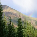
I first came across a description of the Trooper Traverse in an article -- aptly titled "Lost Trails" -- published in the June 2007 issue of
Backpacker magazine (
Subscribe). The Trooper Traverse is a spectacular journey that is rich with history and likely to make a lasting impression on even the least sentimental among us. This 30 mile one-way trip features some of the most pristine high country in the United States. Contact with other humans (on or off trail) is quite limited, as roads and other trails are few and far between. But, if you're up for the challenge, this trip will reward you many times over.
History
The Trooper Traverse was first accomplished in the winter of 1944 by members of the 10th Mountain Division who were headed to Europe to fight in WWII. Some of these soldiers never came home; others went on to become leaders in the wilderness community. The founders of both the
National Outdoor Leadership School and
Outward Bound completed the original Trooper Traverse. For a more in-depth history of the trail and its original participants, see
Lou Dawson's article on Wild Snow.
The Way
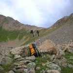
The Backpacker article lacks some information that would be useful for proper planning. For example, Backpacker states there is no technical climbing. While this may be true 'technically' speaking, inexperienced packers may find the descent from Williams Mountain to be a bit intimidating. Also bear in mind that you'll be above 11,000 ft nearly the entire way -- another factor that may be intimidating for less experienced packers. While these details should not be deal-breakers in your decision whether or not to attempt the Traverse, you should be aware that the third and fourth day may go more slowly than you than would typically expect. Plan a solid four days for this trek. Intrigued? Start your planning now for next summer to ensure you have time to properly prepare.
Transportation
Arrange for some sort of pick-up in Aspen. You can either leave a vehicle at the trailhead in Aspen (GPS: 39°12.349'N 106°47.888'W), or better yet: arrange for someone to take you back to Leadville when you’re finished. If you do choose to leave a vehicle in Aspen: from Main St. and Mill St. in Aspen, head North on North Mill St. for .3mi., bear left onto Red Mountain Rd. for 1.1mi., make a sharp left to stay on Red Mountain Rd. and proceed .3mi., make a sharp right to stay on Red Mountain Road and proceed 1.3 miles to the parking area.
To get to the Leadville trailhead, take CO-82 east over Independence Pass from Aspen, head north on US-24 for 11mi. to the turnoff for the Leadville Fish Hatchery, CO-300 for .8mi., turn Left CR-11 for 1.2mi. and make a right onto Halfmoon Road. Follow this road 4.4mi. to the Mt. Massive/Mt. Elbert parking lots. Depending on your vehicle, you may want to park here (GPS: 39°9.103'N 106°25.159'W). High Clearance 4x4 vehicles should be able to make it across Halfmoon Creek and park further up the trail (GPS: 39°9.247'N 106°27.844'N).
Day One
Once parked and ready to go, head up Halfmoon Rd. The first day camp is fairly close to the trailhead, but keep in mind the backpacking version is shorter than the original ski trip of 40mi. That said, you may want to progress past the original campsites on the first two or three days to prevent the last day from turning into a late hike. Remember, the pack trail on the last day that is shown on some maps, no longer extends as far up as shown. The path to night one camp (GPS: 39°9.122'N 106°28.712'W) is not far up the road, but continue on into early evening to get a jump on day two.
Day Two
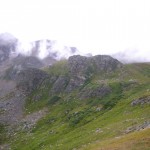
On day two, head back to the end of the valley to Darling Pass (GPS: 39°8.637'N 106°31.207'W) this is a moderate hike, but take your time and enjoy the views over your shoulder as you climb above tree-line. Plan to get a fairly early start as thunderstorms are common in the afternoon. At the top of Darling Pass take a moment to enjoy the view of the meadow valley before you and know that you are one of the fortunate few who have ever had the opportunity to enjoy this view. In June and July (during the height of the wildflower bloom) the views in this valley are absolutely spectacular.
Continue down into the valley toward the small stream drainage. This leads to a pack trail that will lead your ascent to the top of the Continental Divide. Don't get too attached to the idea of being on a trail, however, when you reach the crest of the first little hill, you'll want to veer to the North and proceed up the North side of the valley. A nice shelf near the top of the valley served as the original day two camp. But, if weather permits, continue up to the pass near the divide to camp on the ledge overlooking the valley (GPS: 39°9.289'N 106°33.337'W). There are few campsites in the world that rival the views from here. The wind in this location can be a drawback, but when all's said and done, the view is more than worth it.
Day Three
Get an early start on day three -- take in some breakfast while you enjoy the sunrise over Darling Pass and and watch the morning sunlight fill the valley below. When you're ready to hit the trail, head up the last couple hundred feet to the top of the Continental Divide (GPS: 39°9.389'N 106°33.544'W) and pause for a moment to appreciate crossing this epic boundary. While thousands of people every year cross the divide, very few cross it in such an impressive manner. Once across the divide, traverse southwest along the boulder field. Keep your eyes out for mountain goats and the elusive bighorn sheep. As you
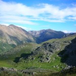
descend the pass, you will see Lost Man Lake far to South. Look for the pack trail that winds down the valley (it follows along the stream leading down from the Lost Man Lake). When you find the "T" (GPS: 39°10.077'N 106°35.534'W), proceed straight though onto what appears to be a foot trail - but quickly fades into vegetation. Other than the altitude and grade, this terrain is fairly easy to traverse.
Extreme Caution
Continue up the ridge to the Southwest to the top of the Williams Mountains. Near the top of this ridge is a great place to drop your pack and take a break, as the descent on the west side (GPS: 39°10.316'N 106°36.960'W) is extremely challenging. This is the most difficult part of the trip. It’s very important to take your time on this descent. The slope is extremely steep and littered with large boulders and medium to small sized scree. If that wasn’t enough to inspire extreme caution, this is where the pack trail to the end should exist but - See note below in 'Planning' section - it doesn't. Proceed down the valley towards Aspen, following any game trails you find heading westerly, and find a nice place to camp alongside the creek for your final night.
Day Four
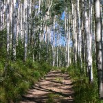
On your final morning continue down Hunter Creek Valley towards Aspen. Keep an eye out for the trail keeping in mind that at many points it fades to vegetation and possibly swamp (during wetter years). Eventually you will pick up a solid trail. Continue on the trail (#35) until you come out on an old 4x4 road. Follow this road until you reach the intersection for Woody Creek. Stay left at this intersection, continuing down the valley. Follow the main trail past several other forks. You'll end up skirting the edges of a very large summit - it's very steep so watch your step. Continue down the large 4x4 road to Red Mountain Rd. where your car should be located. Finally, head down to Aspen for a well-deserved beverage and an early dinner!
Planning
For route planning use the National Geographic Trail Illustrated 127 Aspen/Independence Pass ({amazon}B000YU8S8M Buy{/amazon}). This map shows the pack trail in Hunter Creek Valley more accurately than the USGS Quadrangle. And almost as if it were made for this route, it conveniently covers Leadville to Aspen. Plus, it is waterproof and tear resistant so it should hold up nicely for the duration of the trip. Note that the pack trail shown in the Hunter Creek Valley doesn't extend as far up the valley as the USGS 24K Topo maps show.
Summary
Keep in mind however that the entire route is at high altitude and of course, is quite remote. Proper planning is the key to not only enjoying the trip but being safe in doing so. Keep and eye on the weather before you head out and during the trip. Four full days is sufficient for the trip but could be done in three for fast packers and five for those who want to take a little extra time. The Trooper Traverse is a challenging route that will put you in the backcountry that is
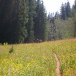
as pristine now as it was in 1944. Add to that the knowledge that you're following in the footsteps of some truly brave men, and I think you'll find this to be an experience of a lifetime.
Quick Info
Location: Hunter Fryingpan Wilderness, Colorado, USA
Permits: None
Distance: 30.8 miles
Difficulty (1-10): 8
Beta: Trail Illustrated 127 (
Buy)
Backpacker Magazine, June 2007
[geo_mashup_map]